Feature
Seven Cemeteries Offer Testimony to Gaya
By Ha Seung-cheol, World Heritage Nomination Office for the Gaya Tumuli
Gaya Burial Grounds Poised for World Heritage Inscription
Multipronged efforts have been underway since 2012 to help the Gaya Tumuli become inscribed on UNESCO's World Heritage List. The Gaya Tumuli is a serial property consisting of seven cemeteries from the Gaya Confederacy, a group of small states that existed in shifting configurations through the southern portion of the Korean Peninsula from the first through mid- sixth centuries. The nomination project began with the Daeseong-dong Tumuli, Marisan Tumuli, and Jisan-dong Tumuli, which were joined by four more sites in 2018. The seven components of the nominated property are the respective burial grounds for the ruling classes of each of the seven Gaya polities confirmed to date. They are the Daeseong-dong Tumuli of Geumgwangaya, the Marisan Tumuli of Aragaya, the Okjeon Tumuli of Daraguk, the Jisan-dong Tumuli of Daegaya, the Songhak-dong Tumuli of Sogaya, the Yugok-ri and Durak-ri Tumuli of Gimunguk, and Gyo- dong and Songhyeon-dong Tumuli of Bihwagaya.
The Gaya Tumuli was registered on the Tentative List in December 2013 and selected as a candidate for World Heritage nomination about seven years later in September 2020. The nomination dossier was promptly submitted to the World Heritage Centre in January 2021. In the autumn of the same year a field mission was carried out by the International Council on Monuments and Sites (ICOMOS), an advisory body to the World Heritage Committee. ICOMOS requested additional information to more fully evaluate the nominated property, and it was submitted in February 2022. The Gaya Tumuli is now awaiting a final decision by the World Heritage Committee at its 45th session, which was originally planned to be held in Kazan, Russia in July 2022 but has been indefinitely postponed due to the ongoing conflict in Ukraine.
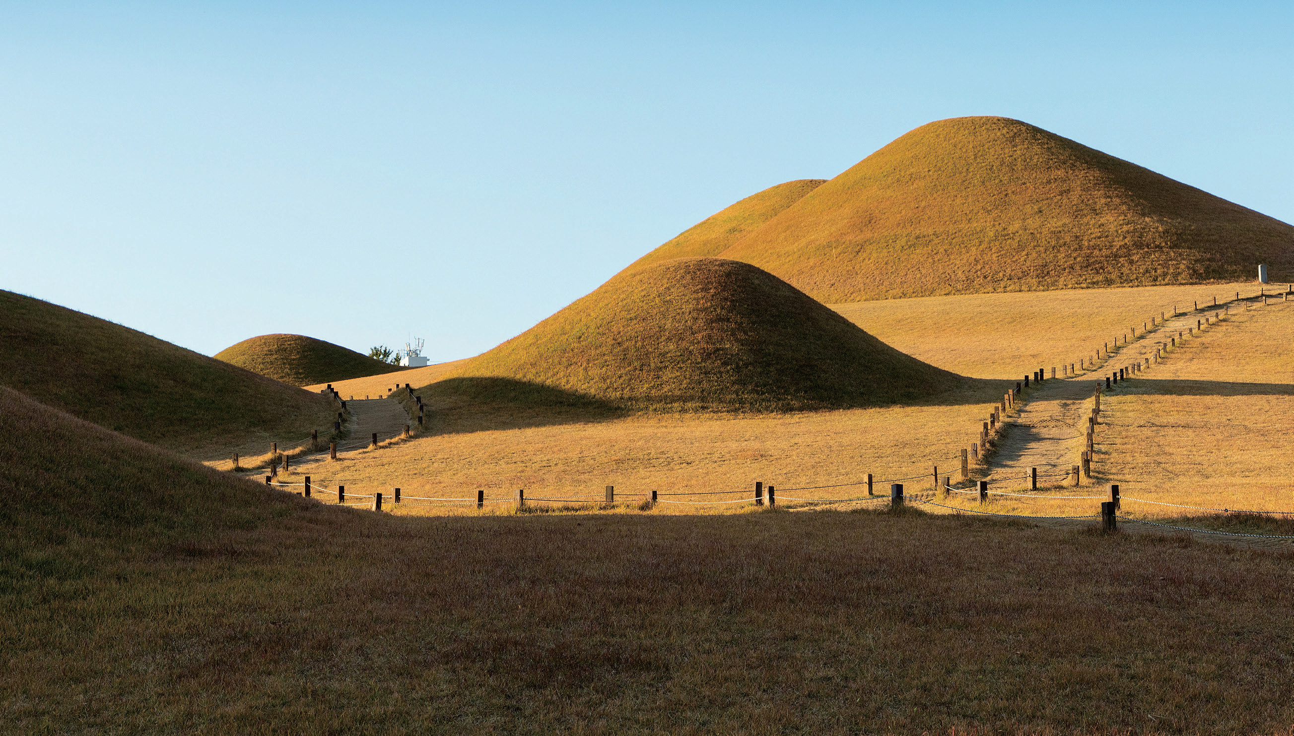
Songhak-dong Tumuli
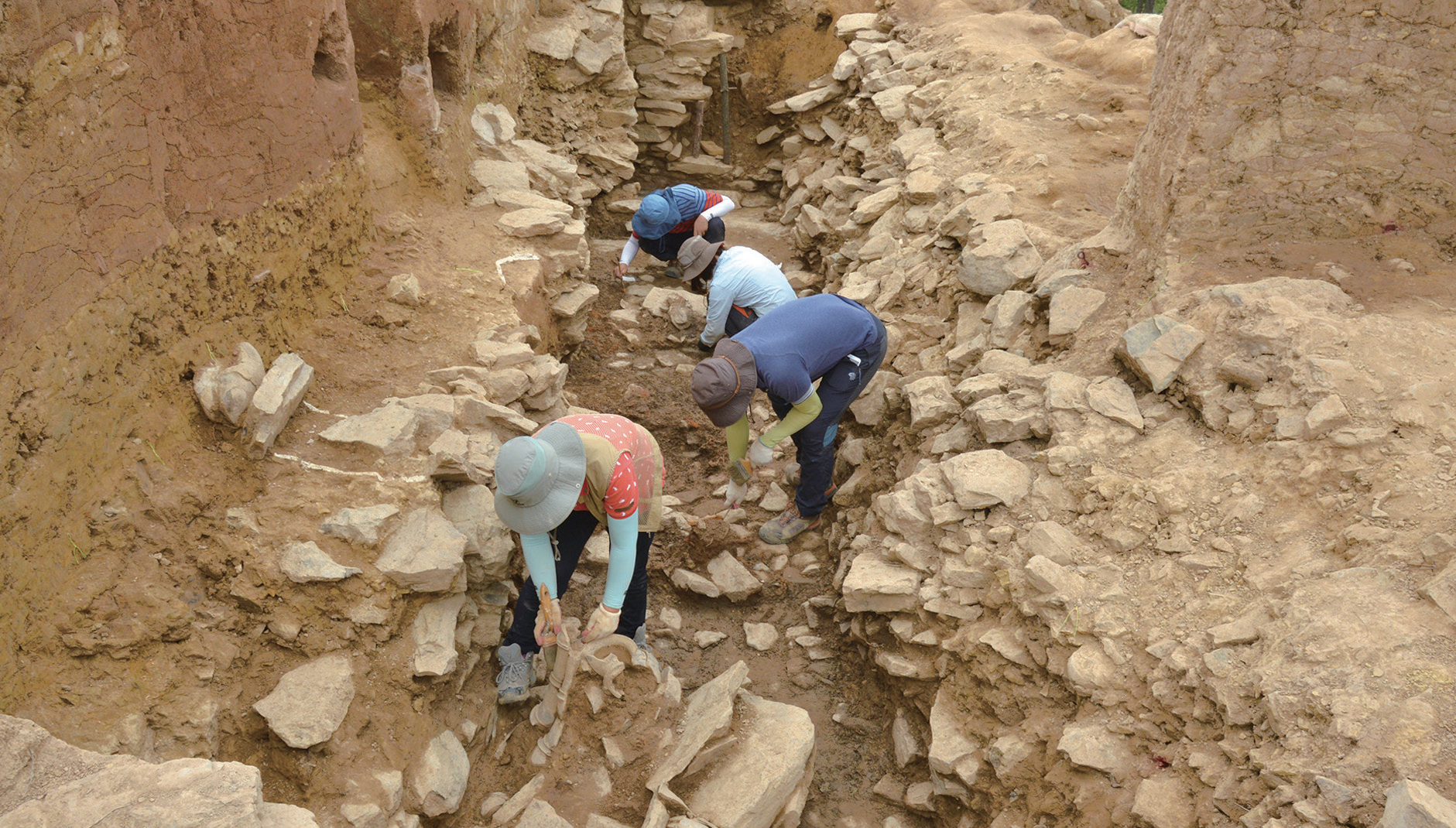
An archaeological investigation underway at the Marisan Tumuli
Gaya, a Federation of Multiple Polities
The term "Gaya" is widely used in academia and across society to collectively refer to a series of small polities affiliated in a confederacy in the southern part of ancient Korea. Although there are no surviving documents produced by the confederacy, some of its contemporaneous or later neighbors in Korea, China, and Japan have left related records. These historical accounts offer information including the names of its member polities. There were polities containing the suffix "gaya" in their names and also some whose names end in the syllable "guk." It has been suggested that individual polities in the southern section of ancient Korea would connect with and separate from each other depending on their needs within a single cultural and political sphere.
Although there are no historical documents telling the full history of Gaya, records are available on when the Gaya civilization began and ended. The 13th-century Korean history Samguk yusa (Memorabilia of the Three Kingdoms) recounts that King Suro founded a state named Garakguk (another historical name for Geumgwangaya) in 42 CE. Dates of Gaya's fall can also be found in the Memorabilia of the Three Kingdoms and in two other documents, the 12th-century Korean history Samguk sagi (History of the Three Kingdoms) and the eighth-century Japanese history Nihon shoki (Chronicles of Japan). It is noted in these records that Geumgwanguk (Geumgwangaya) fell in 532 and the entire Gaya Confederacy, including Daegaya, collapsed in 562. There are some academic disputes over the date of Gaya's founding: Some have suggested the second or third century CE as the point of origin for the Gaya civilization. Regarding the fall of the confederacy, there is a consensus among historians on the year 562.
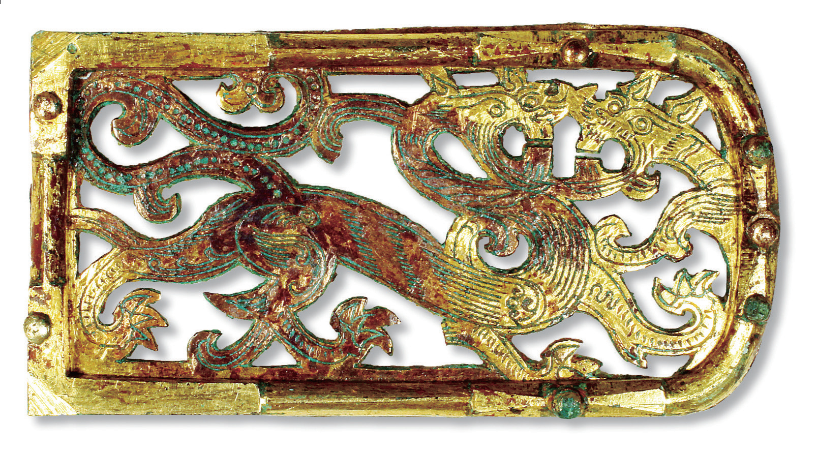
A belt decoration excavated from the Daeseong-dong Tumuli
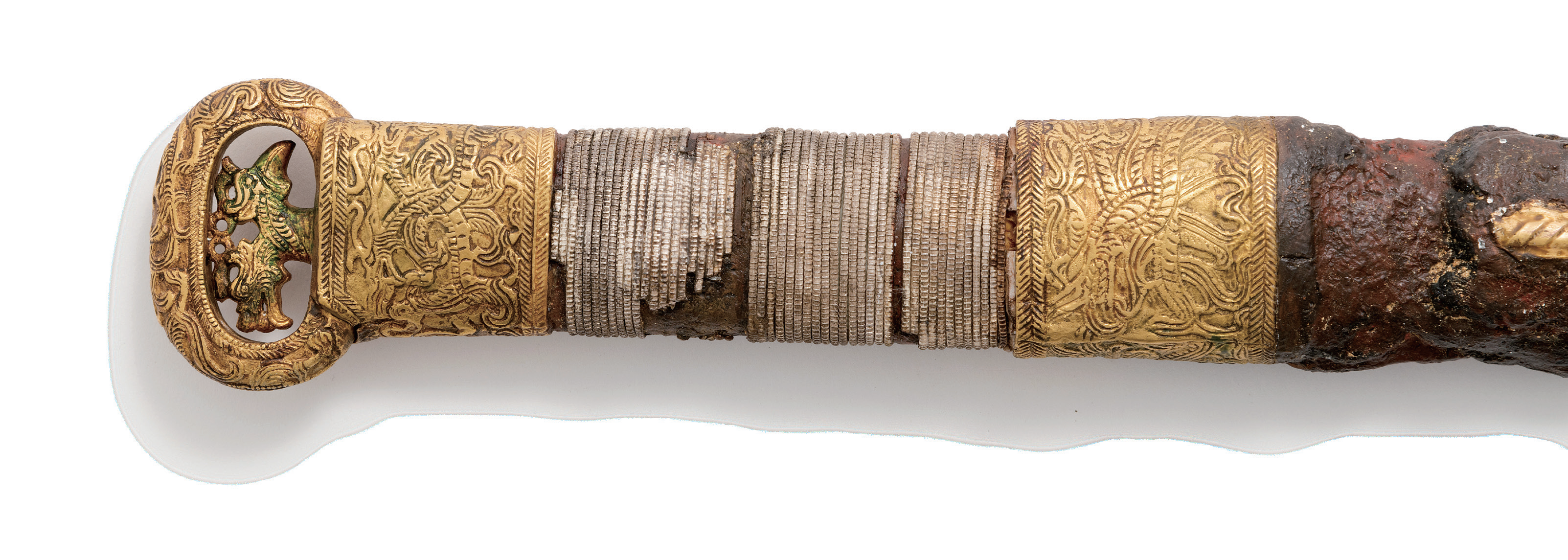
A longsword with a dragon and phoenix design from the Okjeon Tumuli
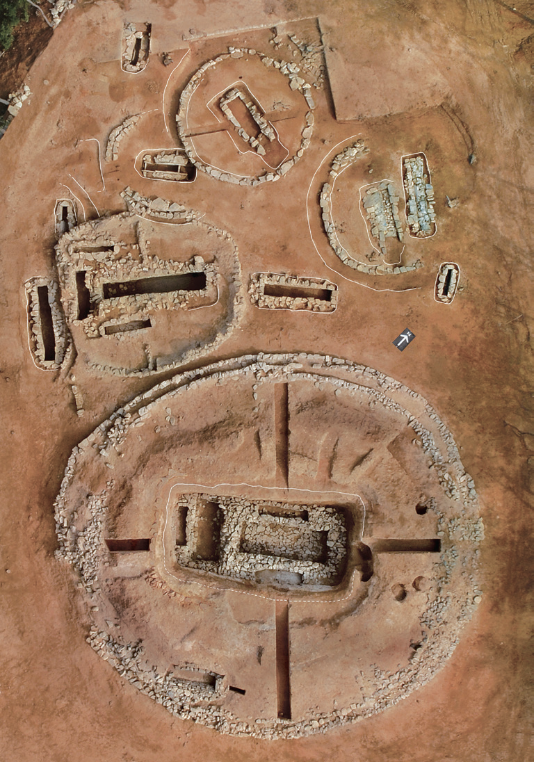
Tomb No. 73 and nearby tombs at the Jisan-dong Tumuli after excavation
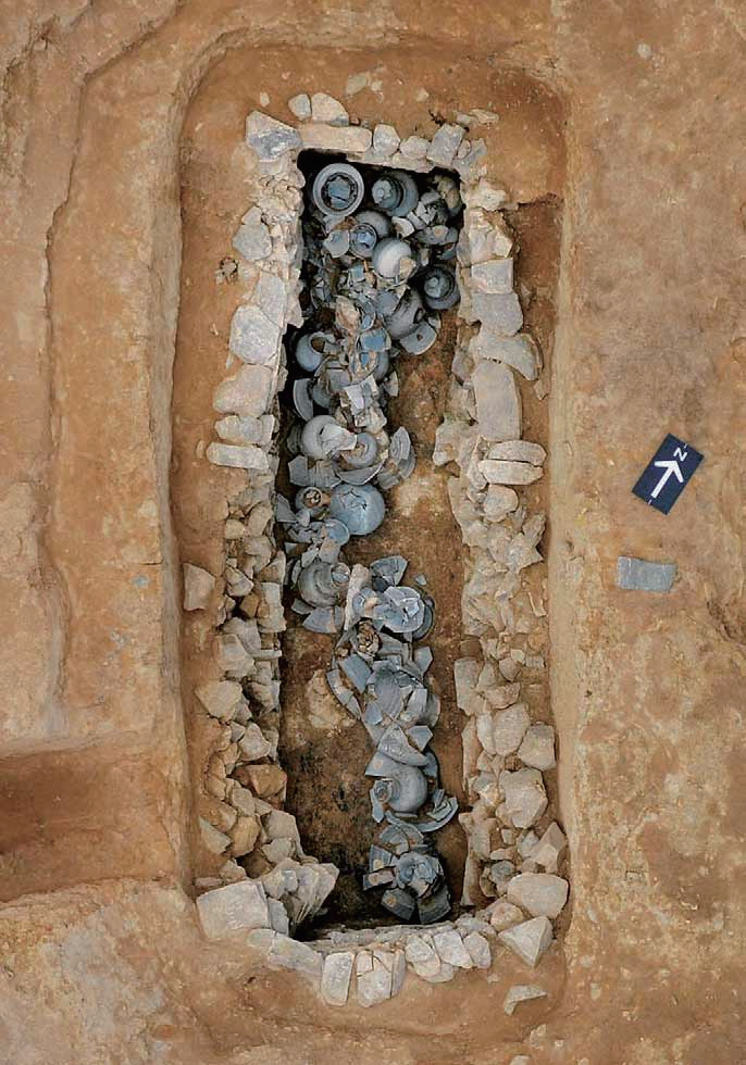
An accessory chamber, part of Tomb 75 at the Jisan-dong Tumuli
The Memorabilia of the Three Kingdoms relates that Gaya bordered Mt. Gayasan to the north, the Nakdonggang River to the east, the ocean to the south, and Mt. Jirisan to the west. This area generally corresponds with what is today the entirety of Gyeongsangnam-do Province and the Goryeong area in Gyeongsangbuk-do Province. However, there is an increasing body of research that supports a broader boundary for Gaya than that recorded in the Memorabilia of the Three Kingdoms. According to this, areas located east of the Nakdonggang River and west of Mt. Jirisan were also part of the Gaya zone, such as Changnyeong, Busan, and Miryang to the east and Jangsu, Namwon, Suncheon, Yeosu, and Gwangyang to the west. Accordingly, it is now understood that Gaya emerged in today's Gimhae and other areas along the lower reaches of the Nakdonggang River and gradually expanded further inland into the Gyeongsang region and the eastern portions of the Jeolla region. Archaeological research carried out since the 1980s in the area previously controlled by Gaya has been making significant contributions to the understanding of this ancient civilization.
The Gaya Tumuli as Evidence of Gaya
The Gaya Tumuli provide considerable information about Gaya, a unique ancient East Asian civilization that coexisted with its more strongly centralized neighbors but maintained a distinct confederated political system. The nominated property is important evidence of the diversity to be found among ancient East Asian civilizations.
The multiple polities comprising the Gaya Confederacy harmoniously coexisted with each other but did not coalesce under more centralized rule as did other contemporaneous states on the Korean Peninsula, including the Goguryeo, Baekje, and Silla Kingdoms. Individual Gaya polities were located in basins surrounded by high mountains or bordered by the sea. This preference of Gaya polities for basins as the seat of their power guaranteed them a high level of autonomy, but it could have caused social and cultural isolation. The polities, however, took advantage of nearby overland and water trade routes to carry out robust interactions with each other, sharing collective cultural characteristics and ultimately developing a homogeneous civilization. In addition, each of them freely formed close relations with other centers outside Gaya, responding flexibly to political shifts in ancient East Asia and contributing to maintaining the balance of power in the region.
Through their geographical distribution, locational characteristics, types of burials, and interred grave goods, the nominated cemeteries provide evidence of the distinctive political system maintained by the Gaya civilization that allowed the affiliated polities to exist as autonomous political equals while sharing cultural commonalities. The seven cemeteries are all sited in highly visible hilly areas in the political center of their respective polities and show dense concentrations of burials constructed over long periods of time. Burial constructions and grave goods excavated in the seven cemeteries display general affinities in style and provide indicators of the geographical limits of the overall Gaya area. The stylistic differences in some of the details point out the boundaries of the sub-areas respectively controlled by individual Gaya polities. The prestige goods found in each of the seven cemeteries are similar in their artistic development, suggesting the relative equality enjoyed among members of the Gaya Confederacy.
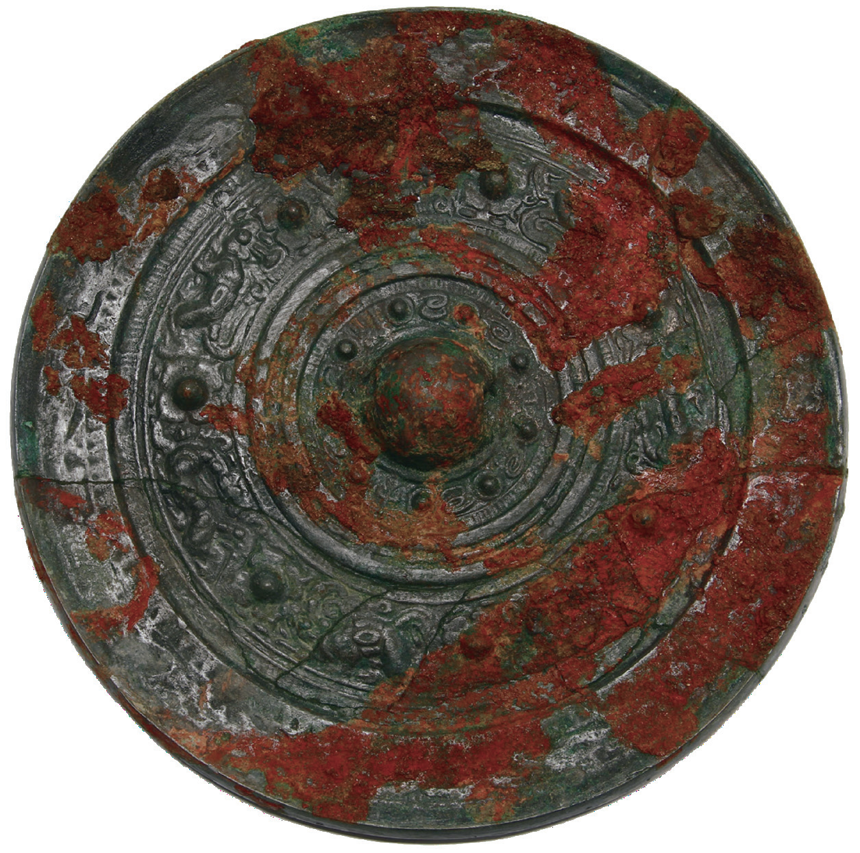
A bronze mirror excavated from the Yugok-ri and Durak-ri Tumuli
Gaya's Contribution to East Asian Civilization
By maintaining a distinctive confederated system, Gaya made significant contributions to the development of the wider East Asian cultural sphere. Ancient East Asia was an open cultural block where ideas, goods, and people flowed freely across different social groupings. Talented engineers and skilled artisans moved around China, Korea, and Japan, and Chinese writing systems, Confucianism, Buddhism, and legal codes were disseminated across the region. Located in the southern part of the Korean Peninsula, Gaya served as part of the bridge connecting China and Japan. The confederacy maintained a systematic network of trade routes across the sea, along rivers, and over land. Geumgwangaya and Sogaya conducted trade with China, Baekje, and Japan through the East Asian maritime routes crossing the south coast of Korea. Aragaya, Daraguk, and Bihwagaya used riverine routes along the Namgang and Nakdonggang Rivers to link various entities within the Korean Peninsula. Gimunguk followed overland routes to conduct interactions with China, Baekje, and other Gaya polities. Daegaya, which grew in power based on the abundant deposits of iron and gold in its territory, took advantage of trade routes along the Nakdonggang and Seomjingang Rivers to carry out trade with its neighbors. This trade freely encouraged exchanges of culture, developing the Gaya civilization into an open and multicultural space. Although fragmented into multiple small polities, the Gaya Confederacy was not quickly subsumed by its stronger neighbors, but thrived for an extended period of time by serving as a trade center in ancient East Asia. The Gaya Tumuli exist today as a precious window through which people can learn about the dynamic, diverse, and open aspects of ancient East Asian society.